http://floridaroads.org/

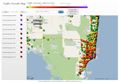
Found this site thru one of my GIS blog feeds. I would be curious to disect the data to look at differences in traffic congestion "off-season" and during the "snowbirds's arrival". The site allows for the standard "pan/zoom" or you and select by community/town of interest.
From the site:
"The Florida Traffic Growth Map highlights the busiest roads and highways. From 2005-2007, many roads and highways have seen at least a 50% increase in traffic. The map highlights the pace of change and increased utilization of Florida's infrastructure. In some areas the road conditions have changed significantly. The data is derived from the Florida Department of Transportation website. Each icon represents the location of a traffic counter and once clicked shows the annual average daily traffic (AADT) counts...."
No comments:
Post a Comment