Click here to view full image (5511 kb)
From one of my NASA Earth Observatory News eblasts:
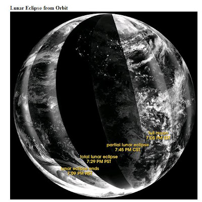
On February 20, 2008, sky gazers from the central Pacific to Africa saw the full Moon turn a striking red as it passed into Earth’s shadow. From space, the lunar eclipse deepened the darkness of the night. The Defense Meteorological Satellite Program’s (DMSP) F16 satellite captured this view of the eclipse as the satellite flew over the nighttime side of the Earth in a series of overpasses. The earliest overpasses are on the right, where bright light from the full moon reflects off clouds over the Atlantic Ocean and the east coasts of North and South America.
Full story at: http://earthobservatory.nasa.gov/Newsroom/NewImages/images.php3?img_id=17963
No comments:
Post a Comment