http://www.style.org/iraqielection/
An interesting display of the election results.
Taken from one of my GIS e-magazines:
Mapping the Iraqi Election and Morecompiled by Nora Parker, Managing Editor
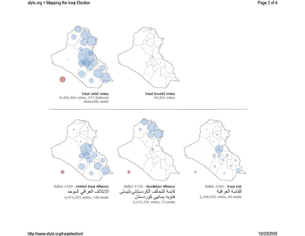
Don Cooke of Tele Atlas alerted us to an interesting website, published by Jonathan Corum of 13pt. Not only does it have some interesting maps (like the January 2005 Iraqi election one shown below), but other fun goodies such as a "composite panorama of Mars" and "The Strouhal Number in Cruising Flight" which has to do with the fact that animals swimming or flying at cruising speed use "similar ratios of stroke frequency and amplitude to forward speed." The Iraqi maps break down the vote in each of 18 governates by eight political parties. The map below shows the total valid votes by governate.
Out-of-country votes are indicated by the red dot to the southwest, outside the country boundary. The maps are interactive and allow you to choose various display parameters.
No comments:
Post a Comment