Esri News Feed

Thursday, April 29, 2010

Airplane Finder 101: Mapping an Aircraft

Just got back from a business trip - thought these images were hysterical.

Full credits to to South African Travel Blogger Chris Rawlinson and FlowingData for bringing this to my attention (and a good laugh).


Quick "cut & paste" from the official press release:

"...The design covers the planes exterior in a tongue-in-cheek guide to the various parts of the planes interior, such as the “Mile-high initiation chamber”. The plane is just one of a fleet expansion of eight state-of-the-art Boeing 737-800s (each with a unique livery). As these planes will be replacing the 737-400’s currently used in kulula’s fleet, South Africans can look forward to spotting the new 800’s during this year...."


Official Press Release - Kulula Flying 101


For a bit more info on Kulula from Wikipedia:

" ...www.kulula.com is a South African low-fare airline.It is now known as Kulula Air. It operates domestic services to all major cities and regional services to Namibia, Mauritius, Zambia and Zimbabwe... The name kulula is Zulu for easily..."

Friday, April 09, 2010

Map of Florida Area Roads and Traffic Growth

Florida Traffic Map  - Map of Florida Area Roads and Traffic Growth

http://floridaroads.org/
Found this site thru one of my GIS blog feeds. I would be curious to disect the data to look at differences in traffic congestion "off-season" and during the "snowbirds's arrival". The site allows for the standard "pan/zoom" or you and select by community/town of interest.
 
From the site:
"The Florida Traffic Growth Map highlights the busiest roads and highways. From 2005-2007, many roads and highways have seen at least a 50% increase in traffic. The map highlights the pace of change and increased utilization of Florida's infrastructure. In some areas the road conditions have changed significantly. The data is derived from the Florida Department of Transportation website. Each icon represents the location of a traffic counter and once clicked shows the annual average daily traffic (AADT) counts...."

Wednesday, March 24, 2010

SRC Becomes Alteryx®, LLC


The Alteryx brand has emerged as a leader in the current spatial business intelligence revolution. SRC, LLC has changed its company name to Alteryx, LLC; the product brand introduced in 1997 has become the strongest standalone Geographic Business Intelligence® software platform in the world today.

The Alteryx technology has matured into the first integrated business intelligence platform that delivers a comprehensive set of software, data and services serving local, regional and global markets. “Within our user base, the Alteryx name already identifies our company, and is well known within the international developer community as the trusted leader in streamlining disparate data sources into enterprise workflows,” said Dean Stoecker, Alteryx, LLC CEO and president. “Taking on the Alteryx brand as our company name is a natural evolution of our business, and represents an industry milestone in embedding spatial data into all levels of business logic. We are extending Geographic Business Intelligence to better business strategies and operational decision-making taking place every day across industry, government and academic disciplines.”

Read more


Sunday, February 28, 2010

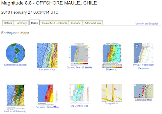
Mapping Earthquakes & Tsunamis: Chile's recent magnitude 8.8 quake

For visual representations of the earthquake and resulting tsunami, here are two great government sources; USGS & NOAA.


From USGS, the have a detailed site (image below):


For NOAA, here are a few quick map highlights of the resulting tsunami.


Energy Forecast in wave height:


Timetracker of wave position:

For some definintions on magnitude - Richter magnitude scale via Wikipedia:

" The Richter magnitude scale, also known as the local magnitude (ML) scale, assigns a single number to quantify the amount of seismic energy released by an earthquake. .... So, for example, an earthquake that measures 5.0 on the Richter scale has a shaking amplitude 10 times larger than one that measures 4.0. The effective limit of measurement for local magnitude ML is about 6.8...."

Mapping for the Gold - Olympics Style:Vancouver’s Olympic Venues


My family & I have really enjoyed this year's Olympic saga. Having some co-workers from Vancouver and parts of Canada added "a nice flair" to watching the events. My favorites - skeleton, short track & anything freestyle. Seemed appropriate to give the Olympics its credit with a map related post. This was first posted online at the NY Times site.

Credits:
Interactive map from the NY Times by SHAN CARTER, MATTHEW ERICSON and JOE WARD; Additional reporting by Melissa Hoppert .


Sources: Elevation data by Intermap Technologies Inc.; satellite photographs by DigitalGlobe, Province of British Columbia and TerraMetrics via Google Earth


A perspective on scale - from point to universe

I like this a short film "The Known Universe" from the American Museum of Natural History, “shows the known universe as mapped through astronomical observations....”. We begin from a point on earth, in this case the Himalayan Mountain range, and then rapidly "expand outwards". This portion of the movie where it shows the “fields of mapped space” intrigued me, particularly the astronomical swath of obscured vision that is "uncharted space". This puts you "in your place" a bit, but is still a rewarding perspective.

Monday, February 08, 2010

Sinam's Favorite Super Bowl ad - Simpson's Coke "Sell Out"

This was an easy choice, as my allegiance to Coca Cola is literally "tattooed" on my ribs - and I've been a Simpson fan for decades. Tame by most measures, and a shameless "sell-out" - but suitable to the "my generation" they are targeting.


Wal-Mart Tightens Delivery Deadlines

Wal-Mart Tightens Delivery Deadlines


Article on balancing Wal-Mart vendor requirements for supply chain inventory mgmt & just in time delivery.

Posted using ShareThis