
Showing posts with label military. Show all posts
Showing posts with label military. Show all posts
Thursday, September 30, 2010
Mapping the Casualties of War - Battlefield to US Hometown
This is sobering interactive display of war casualties, linking battlefield locations to hometowns. Credit to Flowing Data for bringing this to my attention - a collaboration between CNN and Stamen Design.


Thursday, May 28, 2009
A Map for Memorial Day - Sobering remembrance
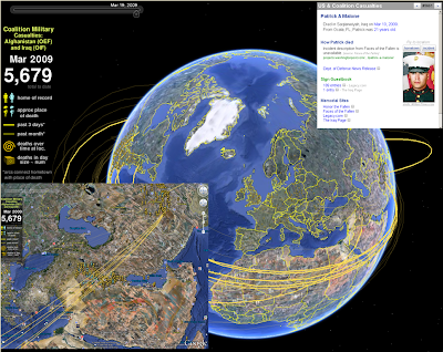 I spent the Memorial Weekend in the Washington DC area. We celebrated my son's 8th birthday, toured the Air & Space Museum, and heard the roar of the Rolling Thunder bikers as they massed on the mall for remembrance of our soldiers' sacrifice.
This particular site (www.MapTheFallen.org) seemed to capture my mixed emotions on the two wars and the sacrifice born by our military. I wish I could bring them all back, and hope this site continues to geographically illustrate their deeds, and emphasize the eternal thanks we owe them all.
In the Google Earth environment, you are able to see home of record, approximate place of death, and other thematic/temporal representations.
Subscribe to:
Posts (Atom)